Horseshoe Inlet: campsite in the scrub.

South West Cape circuit

Posted by Patrick Melon
6 day hike

This hike began at Melaleuca in the South West National Park and World Heritage area of Tasmania. It is a remote and now disused tin mine with a gravel airstrip for light planes and a jetty for small vessels via the Bathurst Harbour. The only other way in or out is on foot by the Port Davey track from Scotts Peak dam (about 4-5 days) or the South Coast Track from Cockle Creek (about 6 days). It is staffed in the summer months by a couple volunteer rangers for PWS and there are also occasional bird watchers who monitor the numbers of the rare and endangered Orange Bellied Parrot. For walkers there are two huts, camping areas and a toilet.

Day 1: I flew into Hobart International airport and transferred to Cambridge airport about 10 minutes drive away. Here Par Avion have their offices and operate light aircraft in and out of Melaleuca weather permitting. The day wasn’t great with light showers, a cloud base around 750 metres and a cool north westerly. There were two other hikers doing the South Coast track, the pilot and a passenger in the front seat acting as ballast to stop the plane tipping backwards on its tail. We were away shortly after 9:30 am and had some great views of the coastline and Iron Bound ranges. The landing strip is small but adequate. It was constructed by Deny King who lived in this remote spot for 55 years. He died in 1991 and his ashes were scattered here. His biography is well worth reading.

Nissan Huts at Melaleuca. Some of these are available for hikers

I left half my food at the PWS registration hut intending to pick it up after the South West Cape circuit and hike out via the South Coast track which I had done before (see blog). In light drizzle I set off. The last time I walked this I had missed seeing the fork where the track turns off. This time I was more careful and spotted the metal stakes and the beginning of the trail down toward New Harbour. The track sidles the New Harbour range from which you get views back toward Melaleuca as a thin white line in the distance.

Melaleuca to New Harbour track

George Creek

After wading through George Creek you enter the coastal forest and eventually drop down to a lovely grassed section by the lagoon. In reverse the track would be quite difficult to find. Here PWS have placed a small registration box for hikers which I filled out. Camping on the lagoon looks to be a pleasant grassy option unfortunately it is tidal.

I crossed George Creek (above) again with a short wade and decided to set up camp further along the beach where there are some sheltered sites. I had thought about going on to Ketchem or even Wilsons Bight but the day had cleared and the sun had emerged making for a pleasant afternoon. The previous night I had only had a few hours sleep so the thought of a relaxing afternoon was too much.

I had brought a green tarp with me to set out above or near the tent. It was quite heavy but in the South West the ability to create a dry area is a benefit. Under the tarp you can set up a tent, cook and change in the often wet conditions.

Looking at the New Harbour range from the campsite

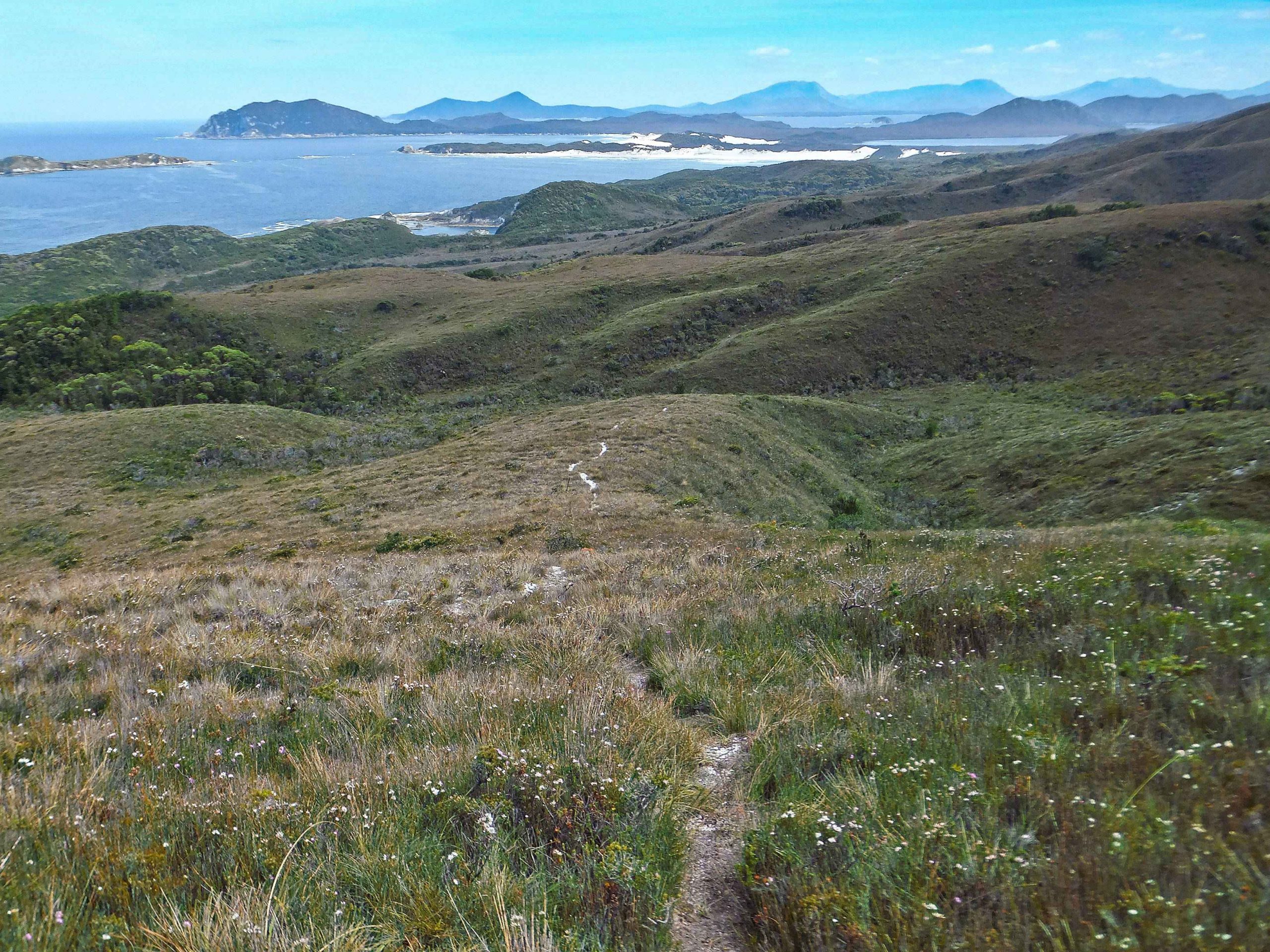
New Harbour to the west from the campsite

DAY 2: New Harbour to Wilsons Bight

A not so early start managing to get away just before 9am. I followed the beach to the first rocks where the usual piece of fishing furniture was hanging from a tree indicating the start of the track. An indistinct pad through coastal forest becomes more distinct as you climb steadily to a high point from which the first views back to New Harbour become visible.

View back to the New Harbour beach

Campsite at 5 Mile beach.

Saw this unusual half cup-shaped brown and cream fungus growing from side of a tree (above). Not sure what its name was.

The path is generally good and eventually brings you to Hidden Bay through a sand blow in the dunes. Stopped on the beach for brunch and then continued to the end of the beach before plunging again in to the coastal scrub. I was thankful for the shade because once out in the open the sun was shining and the day beginning to warm up. The track becomes quite good as it wends its way over the headland giving good views back to Hidden Bay. Here I met a party of four heading back to Melaleuca after camping at Ketchem. They told me that there was a party of two men 2 days ahead and also to consider heading south (I think he meant east) to get to the Port Davey track once I had reached the Pasco Range. This was to avoid Horseshoe Inlet which was in his opinion quite difficult to pass and a difficult section of the SW Cape circuit. If I had been with others I might have considered this option but I didn’t want to do too much navigating on untracked country by myself. In fact this walk is not really suited to solo walkers anyway. Its remoteness and difficulty make it better to hike with a minimum of 4.

I did have Chapman’s notes and sketch maps. These were helpful in following a tried and tested route rather than a new one. I had planned carefully for the Horseshoe Inlet crossing anyway with garbage bags and 20 metres of rope.

I also brought with me (in addition to a PLB) a SPOT satellite messenger. This device sends a message and your map coordinates back to family and friends. The link opens up Google maps which shows your precise location. When I tested it at home the link showed my position to within 10 metres. And when I did get back home the messages sent each day had worked perfectly and correlated with the green light delivered signal from the device itself. I had read poor reviews of this device on the internet but I think I could recommend it as an additional layer of safety especially for solo hikers.

Sand Blow leading on to Hidden Bay

Beach furniture marking exit

Leaving Hidden Bay

Hidden Bay

Track out of Hidden Bay

The track continued till Ketchem came into sight. From here there was a steep descent onto the beach – one of the prettiest along the coast. If time had permitted this would have been a very pleasant place to stay. As it was I wanted to press on as quickly as possible to try to make Wilson Bight at low tide, knowing that the rocks from the 1st beach to the 2nd beach were difficult to cross at any other time.

Ketchem Bay

Ketchem Bay

The Amy Range was a bit of a grind but again the path is very good and soon brings you within sight of the three beaches of Wilson Bight. The first two are sandy beaches separated by a difficult scramble over sharp rocks. The third and final beach from which the exit track leaves is stony. The three beaches are just visible in the picture below. You can also make out from the third beach the ascent spur up to the skyline and then right along to Mt Karamu.

Wilsons Bight: 3 beaches

I did get to Wilson Bight at low tide. Even so the crossing from the 1st to the 2nd beach was slow progress. On the 2nd beach Chapman’s notes make reference to the major camp site to the north behind the dune 50 metres east of the creek. When I investigated I found nothing except some blue tapes on the trees which I think indicate the beginning of the untracked short and direct route to the top of the SW Cape Range (later when I caught up the party of two men at Horseshoe Inlet I found out that they had placed the tapes there and had used that route). I did find the camp sites that John Chapman recommended on the rocky point 30 metres west of the creek. Also the creek had become two creeks quite close together. Without checking on any updates on the route I suspect that what may have happened was that a storm has washed out the major camp sites. I am not sure about this and it is only conjecture. I did use the rocky point camp site which apart from the leeches was nice and sheltered from the wind. A couple of fishing vessels were anchored about 400 metres from the beach, the only company that evening.

There are some interesting rock formations on the beach.

2nd Beach, Wilsons Bight

2nd Beach, Wilsons Bight

DAY 3: Wilson Bight to Window Pane Bay

By all reports this was going to be a long day, 9 hours at least and possibly longer. The route climbs over Mt Karamu then follows the SW Cape range before descending to a staked track leading to Window Pane Bay. In addition the ranges are fully exposed to weather coming from the west. The track is pretty good up to Mt Karamu. From there it becomes a light pad easily lost until meeting the staked track after which the path is easier to follow.

An early start today and I managed to pack up and get away before 7. After climbing over a small headland you descend into the 3rd beach. Immediately on the right there was fishing furniture hanging from the trees. This was not the path but another small and sheltered camp site. Further along at the end of the beach you cross the creek and immediately begin a steep and precarious climb up through the coastal forest. Emerging from the forest at the top the track follows the spur up on to the lower slopes of Mt Karamu. From here looking back you can see clearly the 3 beaches of Wilson Bight.

3rd beach, Wilsons Bight. The trail exits at the far end and climbs steeply

The three Beaches of Wilsons Bight

Behind Wilsons Bight Chapman’s direct route to top of SW Cape range

The path is easy to follow but as I looked to my right I could see cloud beginning to shroud the top of the SW Cape range and just beginning to cover the top of Mt Karamu. This was going to make navigation more difficult. In fact when I reached the summit visibility had dropped to a couple of hundred metres and I lost the pad altogether over the rocky summit.

Mt Karamu

Mt Karamu

Depending on the compass I went over the higher summit of Karamu following a north westerly line. Not sure where I was I then descended east to try to get below cloud level and see the terrain. The saddle between Karamu and the SW Cape range came into view and I made for it. From here another ascent to the top of the SW Cape range brought more cloud and a strong and cold westerly wind which at times was strong enough to blow me off course.

There was water available from small tarns near the summit but I didn’t need it having decided to carry enough water for the day.

A brief lifting of the cloud brought the whole of the range in view in the photo below.

SW Cape Range

The walking is easy along the tops except the approach to the highest knoll on the SW Cape range. This was very scrubby making it difficult to push through the wiry vegetation. Again I got disorientated in the cloud and lost the faint pad. Also the wind was very strong and cold. I sheltered briefly behind one of unusually shaped quartzite boulders and put on warm clothing, full face balaclava and gloves. From here using the compass and rogaining experience I made my way down the north side of the range until below the cloud again. At this point I picked up a pad that brought me to the button grass plain mentioned in Chapman’s notes where the staked track began. Having taken off my glasses I couldn’t see that well but eventually picked out the stake

Window Pane Bay

From the staked track the path is easy to navigate and a long descent brought me to the coastal forest above Window Pane bay.

The last part of the path comes out on the top of a huge sand dune looking over the beach. The overhang caused by erosion made it impractical to jump down with a 20kg pack so I moved carefully along the edge till the jump became easier. A quick toboggan down the dune and I made the beach and walked north. I crossed the creek and found a beautiful camp site tucked away behind the trees. I looked at my watch and found that the trip had taken 10 and 1/2 hours – not so bad given the cloudy tops of Karamu and the SW Cape range. Also I didn’t feel too tired given the length of the day and the strenuous nature of the route.

The Dune

Window Pane Camp Site

Window Pane Camp Site

SW Cape from Window Pane Bay

At the camp site were a party of two who had actually climbed right out to the SW Cape promontory using ropes to get down the final cliff a few days before. They had taken 15 hours to do it and had been successful on this their fourth attempt. A great effort and one that eventually appeared as an article in WILD magazine. They had then camped on top of Mt Karamu then travelled to Window Pane where they had taken a rest day when I arrived.


DAY 4 Window Pane Bay to Murgab Creek

The track out from Window Pane Bay starts about 30 metres down the creek from the camp. The customary furniture marks its beginning. The start is an old overgrown sand blow and the track makes its way up out of the coastal bush and heads north along a well-defined staked path. The path is good all the way to the re entry to the coastal scrub about 1km before Murgab Creek. Here according to reports everyone has difficulty finding their way. The party of two set off very early and indicated they would be putting up tapes to make the final section a little easier.

There were good views of Island Bay and right along the coast.

Island Bay

SW Cape from above Island Bay

staked track looking north

One of the rusted metal stakes that marks some sections of the track. Noyhener Beach is clearly visible in the background.
The last kilometer is not easy navigation. There is a track junction and the obvious path heads straight on. This had been blocked with some branches so I took the less obvious track to the right. This in fact proved to be the right way. From then on I moved slowly and tried to pick out the tapes tied to trees. I made it to the coastline which is marked by a little cairn of white stones.

Noyhener Beach

Noyhener Beach

staked track looking back

Mutton Bird Island

Mutton Bird Island

The last 500 metres is a scramble along the rocks again best done at low tide. The scrub in the forest is thick and not a pleasant option.

Shore line to Noyhener

Shore line to Noyhener


PWS have placed a ladder to help stop erosion when entering the camping area. There were many places to camp here along with makeshift seats and ropes strung between trees for drying wet clothes but the mosquitoes were legion. I didn’t meet anyone all day on this leg and camped alone.

Access to campsite.

View from campsite.

Tanin stained Murgab Creek which supplies the drinking water for the camp.

Tanin stained Murgab Creek.

Noyhener Beach Murgab Creek

Day 5 Murgab Creek (Noyhener Beach) to Horseshoe Inlet

The barometer pressure on my watch had been dropping steadily and rain was expected. I got up early to try to get going before the rain started in earnest. The morning was overcast and clouds were moving in from the west.

The start of the track is the sand dune by the bend in the creek nearest to the camp sites. I followed footprints north through the dunes to the coastal forest. From here there is a faint pad and a few tapes that led to a discarded toilet seat! I continued to follow a faint pad but eventually realised that it was taking me in the wrong direction. The rain started and the visibility diminished. I should have been moving eastward and I could occasionally see the ascent spur on the SW Cape range. However all the while I was following a pad that was taking me steadily northward. I could not now move eastward because there was a steep drop off that way along the line of the undulating hills. Eventually I came to a saddle from which I could travel eastward. I crossed an unnamed creek that drained into Hannant Inlet and ascended an open spur parallel to the ascent spur to the undulating top of the SW Cape Range.

Somewhere on the South West Cape range, north of the track

I deliberately tracked south east across the undulating top of the SW Cape Range until I picked up the pad again. Dropping down to Hannant Creek the path up the Pasco range is clearly visible in the photo below.

Pad up to the top of the Pasco Range

The rain now stopped. At the top of the Pasco range a series of small rock cairns takes you round the north side of the highest point and then the path descend steeply in a south east direction to an open saddle. From here the path becomes easy walking along a series of undulating tops down to Horseshoe Inlet. I was overtaken here by the party of 2 I had met at Window Pane. All but the last 300 metres of the pad is easy to navigate. But as you approach Horseshoe the pad breaks up. After a few false leads I eventually descended through an unlikely section of coastal scrub, crossed the creek and followed the creek on the east side 50 metres to the shoreline.

Horseshoe Inlet west

Horseshoe Inlet west side

The main obstacle in making progress around the shoreline is Horseshoe Creek a short swim of about 15 metres. I decided to do the swim by dividing my rucksack into two and putting them in garbage bags, tying the two bags together with 20 metres of rope and swimming across with one. Then after the swim pulling the other across by hand.

Given the low tides I could have probably avoided a swim by wading out into the sea for about 50 metres but the swim method worked flawlessly. The next two creeks around the shoreline were easily passed by wading out into the sea about 30 metres (knee deep).

Horseshoe Creek swim crossing

Horseshoe Creek crossing east side

Horseshoe Inlet looking north

Horseshoe Inlet looking to Mt Rugby (centre)

The campsite is on the east side of the Inlet. A party of two were already camped there but because of the strong wind blowing off the sea I camped well inside the coastal forest for shelter.

Horshoe Inlet east end and camp site

DAY 6 Horseshoe Inlet to Melaleuca

The original plan was to hike to Melaleuca, pick up the food drop and then hike out via the South Coast Track. During the evening while camped at Horseshoe the rain started. It came down heavily through the night and into the morning. My tent developed two small leaks where the tensioners come into the inner. I should have put up my tarp shelter above the tent as I did at New Harbour so that at least I had a dry area to pack up and a dry tent. As it was I had to pack up inside the tent and rolled up the tent wet last of all. The Port Davey track is only a couple of hundred metres away to the east and easily accessed across untracked button grass. Once I had reached the Port Davey track all concerns about navigation disappeared and I thought the rest of the walk would be relatively straight forward. I was wrong. The heavy rain continued to swell the creeks and the track itself was nothing more than a fast flowing stream of water most of the way. In hindsight I wished I had walked out the previous evening when the track was dry. Then I could have spent the night in one of the two huts at Melaleuca with a dry start the next day.

The next 4 hours were unpleasant. Even the minor creeks had swollen to the point where a chest deep wade across two fast flowing streams became a necessity. Thankfully the creek before Charlies Hill had been bridged. Melaleuca Creek was a raging torrent but also had a single log bridge with a wire stretched across to hold on to.

I reached Melaleuca about midday. By this time I had decided not to try to continue down the South Coast track. There were several major creeks and rivers to cross and it would have been unlikely I could have made the Wednesday deadline for the bus at Cockle Creek.

No planes had come in that day and a couple of groups were stranded waiting for flights out. Friday started out just as unpromising with more rain. However around midday the sound everyone had been waiting for. Two Par Avion planes arrived unexpectedly and with room for those of us who had not booked to fly out. Had some great views on the way back to Hobart.

This was a great walk and better than the South Coast track because less mud. Next time I will buy 1:25000 maps to navigate with and dispense with the 1:100,000 which is useless unless there is already a track. Also I will take Tide tables to make sure beach and foreshore crossings coincide with low tide.

Port Davey Track back to Melaleuca

Port Davey Track (Melaleuca Inlet on left)