Prion Boat Crossing

South Coast Track

Posted by Patrick Melon
7 day hike

This was a solo walk which took 7 days to complete the 85km trek. The main difficulty is getting over the Ironbound range which can be unpleasant in bad weather. Though the pictures below suggest a pleasant coastal walk along sun-soaked beaches the reality is that the bits in between can be really muddy. Extensive upgrades to the track have been made and plans are afoot to put in private huts.
The start is at Melaleuca which can be reached flying Par Avion from Cambridge Airport just outside Hobart, Tasmania. The flight is spectacular and you can see from the air much of the track as a white ribbon meandering its way through button grass plains. The first picture below shows Precipitous Bluff and New River Lagoon.

DAY 1 Melaleuca to Point Eric (3 1/2 hours)

The runway at Melaleuca is a disused tin mine with a scattering of Nissan huts.

Melaleuca is known for two things. Its association with Deny King who mined the tin and began serious conservation work as well as the rare and endangered orange-bellied parrot.  Some of the buildings house volunteers working to save the orange-bellied parrot. One building functions as a bird hide from which it is possible to see the orange-bellied parrots feeding.
Deny King built the airstrip.

Track to Cox Bight: Looking back to airstrip on left

Just short of Cox Bight a clap of thunder from Melaleuca heralded a fast moving storm approaching.

Melaleuca to New Harbour track

Cox Bight beach which leads to Point Eric

DAY 2 Point Eric to Louisa River (5 hours)

A walk west along the beach brings you to the black cliff complete with warning signs. I was able to pass this quite easily at low tide.

Black Cliff

 The path leaves the beach at Buoy Creek which is marked by a fishermans buoy hanging from a tree in the coastal scrub. In fact all beach exit points are similarly marked. Some wet button grass plains lead to the foot of the Red Point Hills. The weather then turned from sunny and warm to rain for almost the rest of the day. Two creek crossings added to the wet feeling. Both of the creeks had dark red tannin stained waters. I took off my boots for the first but didn’t bother after that. My feet were already wet most days anyway.

Tanin stained Louisa Creek crossing

Arrived at Louisa River and not having had much rain for the past few days crossed it easily. I camped at the far side in case the weather changed during the night. A long day and not being used to carrying a heavy pack quite tired.

Louisa River crossing and 2nd night camp

DAY 3 Louisa River to Little Deadmans Bay (8 hours)

Slept fitfully through the night wondering whether the weather would be good enough to cross this 900 metre range. In the morning my watch showed the barometric pressure trending upwards and predicted a fine day, which it was. The path was good on the climb up with views westward to Louisa Bay.

The climb up the Irobounds

Panoramic view of Louisa Plains from Ironbounds

The highest point of the path does not quite reach the summit but starts downward through sub-alpine flora and gives views east to Prion Beach.

Highest Point brings views of Prion Beach

The track down can hardly be called a track. It is a twisted tangle of roots, mud and fallen trees and obviously becomes no more than a watercourse in rain. Additionally it seems to go on for ever. I passed a party of three who had stopped for a cup of tea at the Ironbounds low camp. Once out of the watercourse the track turns eastward and improves. The last 2 kilometres is a pleasant walk through light forest.
The camp at Deadmans is one of the prettiest on the whole hike. I felt in good shape even though it had been a long day.


Campsite at Little Deadmans Bay

DAY 4 Little Deadmans Bay to Osmiridium Beach (5 hours)
It was the best of paths and it was the worst of paths. The park ranger and a group of other trainees were also camped at Deadmans. I thought I had experienced mud but he assured me worse was to come. Shortly after leaving Deadmans I encountered some really bad sections which slowed progress right down. Numerous attempts have been made by others to by-pass the mud which has resulted in rabbit trails running off everywhere. There is no escape!
At Grotto Creek at the west end of Prion Beach there is a boot wash down station not to get clean that is impossible but to stop spread of a particular plant. Prion itself is a lovely 4km walk along hard sand with the ocean on one side and the mountains on the other.

Muddy Boots

Turua Beach between Little Deadmans Bay and Grotto Creek
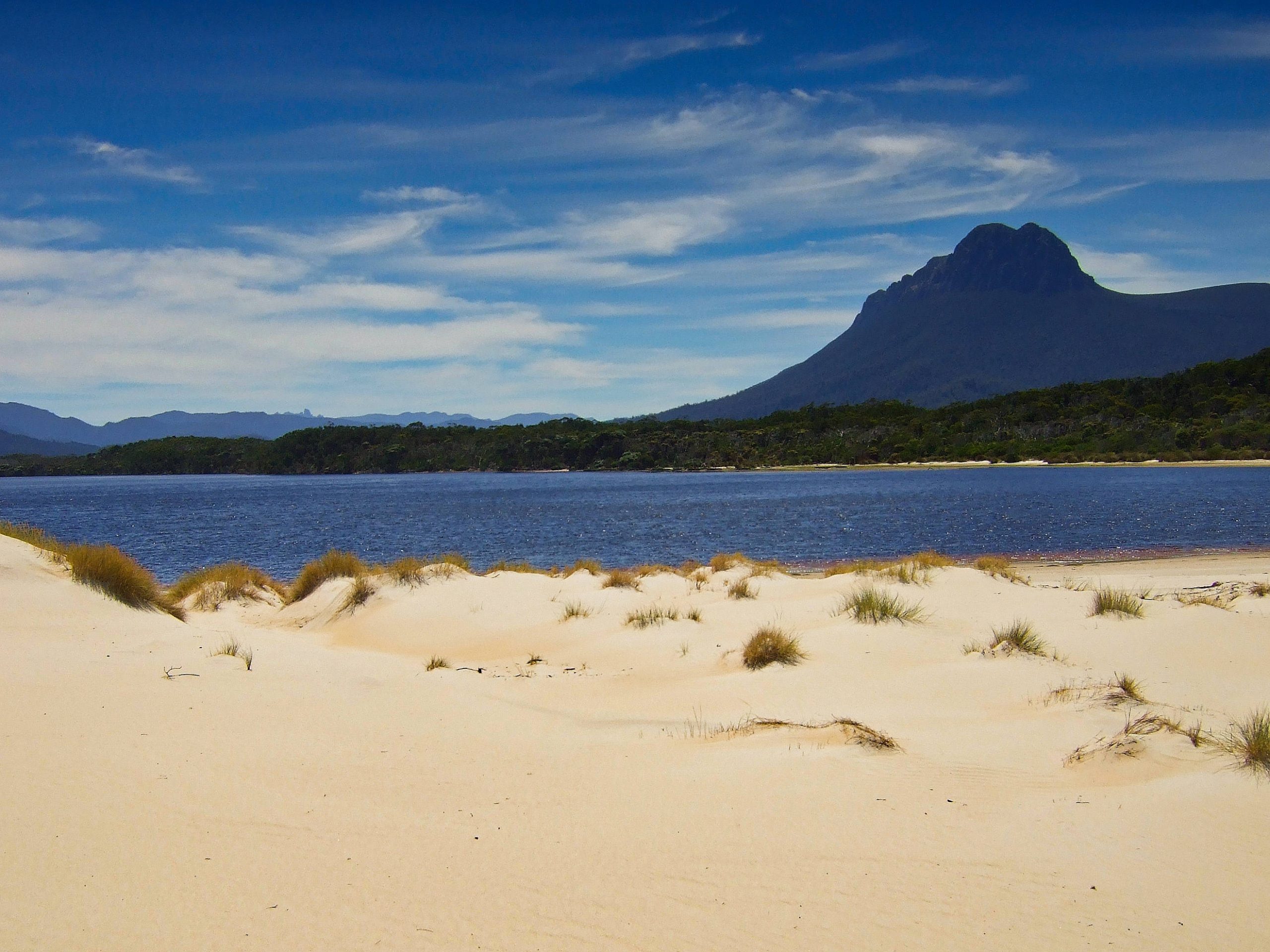
The Iron Bounds from Prion Beach

Prion Beach

PB from Prion Beach

Prion Bay boat crossing is interesting. You have to row across three times to leave a boat on either side

The boats are quite heavy for one person

PB and New River Lagoon

On the third journey across I shared with 3 others and all their hiking gear. The water lapped perilously close to the gunwale. I began to wonder whether swimming might be a possibility and feared my camera would be ruined. Also the wind picked up and made the rowing hard. From the boat crossing a short walk leads into the campsite. The track then follows the coastline towards Milford Creek.


Low in the water with heavy rucksacks

Along the top of the dunes from Prion crossing I encountered my first snake.

Along the top of the dunes leaving the boat crossing

Milford Creek crossing

The hardest part of the whole walk was actually getting off the beach as the steps are completely gone. About 1 1/2 km later a sign signals the turn off to Osmiiridium Beach.

Osmiridium turn off

Osmiridium Beach

DAY 5 Osmiridium to Granite Beach (3 hours)

The easiest day of all. A short day through pleasant coastal scenery crossing Surprise Bay.
Later you cross Granite Beach which consists of soccer ball size rocks and is hard on the ankles. The camp site is a short climb up a cliff over the creek and then into the camping area. There is a waterfall over the cliff for a shower.
During the night a frontal system passed through. The noise of the wind was like sitting under a jet engine. No rain and surprisingly the tent hardly stirred under the coastal scrub.

Surprise Bay

End of Granite Beach – a short climb up the cliff to the campsite

DAY 7 Granite to South Cape Rivulet (7 hours)

Another hard day starting with a climb over the South Cape range – nothing as bad as the Ironbounds but wet and muddy. Good views back to the Ironbounds from the top.

View from South Cape Range

South Cape Rivulet

DAY 8 Final Day South Cape Rivulet to Cockle Creek (4 hours)

An easy walk out to Cockle Creek. Hardly any mud but a great coastal walk. The first landmark of note is Coal Bluff followed by Lion Rock.

Coal Bluff

Below Lion Rock and exit from the coast along Blowhole valley and to journey’s end, Cockle Creek

Lion Rock

Blowhole Valley

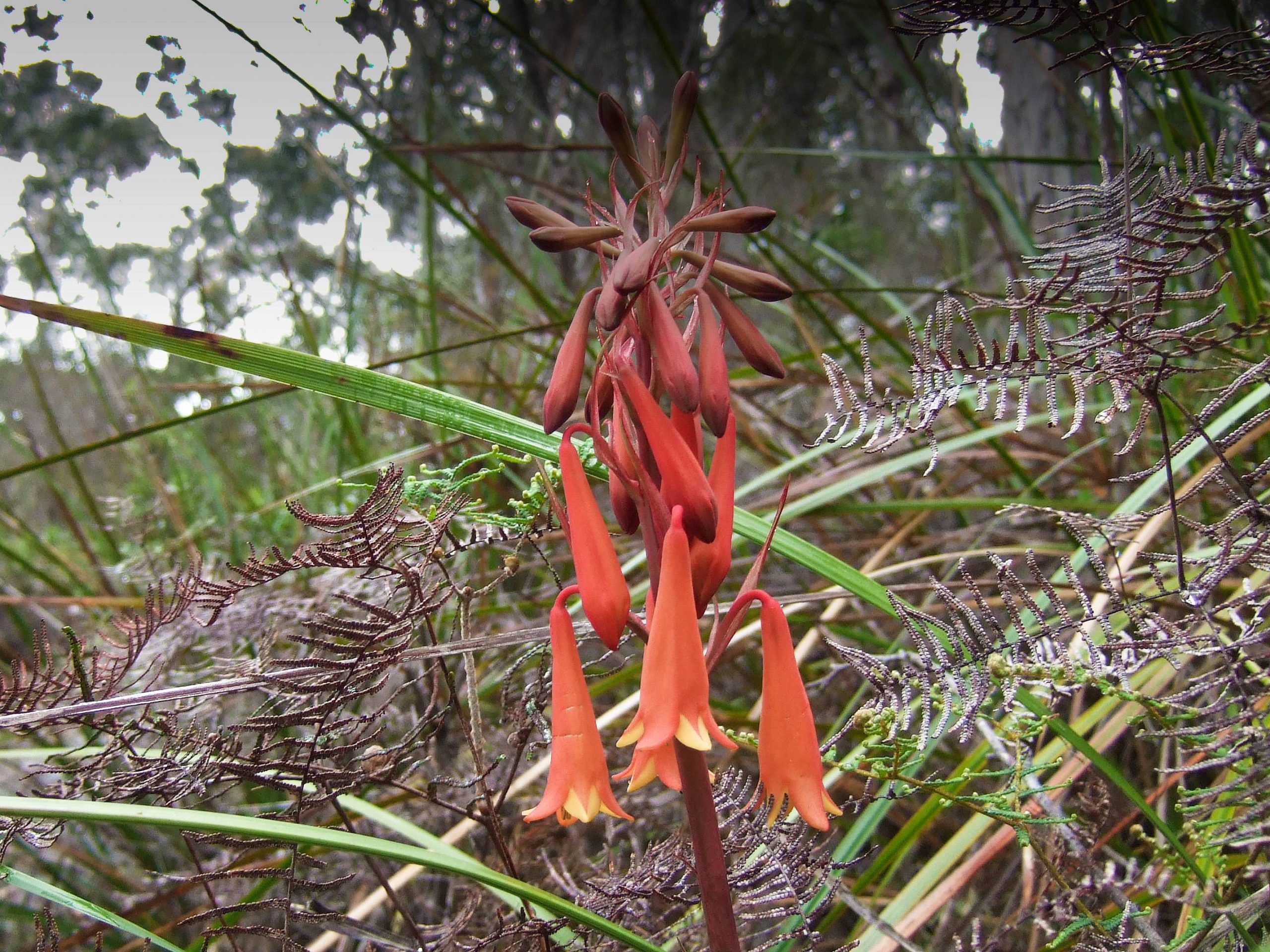
Blowhole Valley Christmas Bells

Finally Cockle creek and the end of the walk which features a (de) Registration booth , a bridge, telephone, camp site and Ranger station.

Bridge at Cockle Creek

The video below is not great quality being taken on a cheap camera but it shows sections of the hike from each day. Enjoy!

Play Video

I camped here one more night before picking up the Evans coach (no longer running) to take me back to Hobart at midday. A beautiful spot but a lot of mosquitoes.

This is one of the best walks I’ve done but because of the mud and state of the track it would not be everyones’ choice.